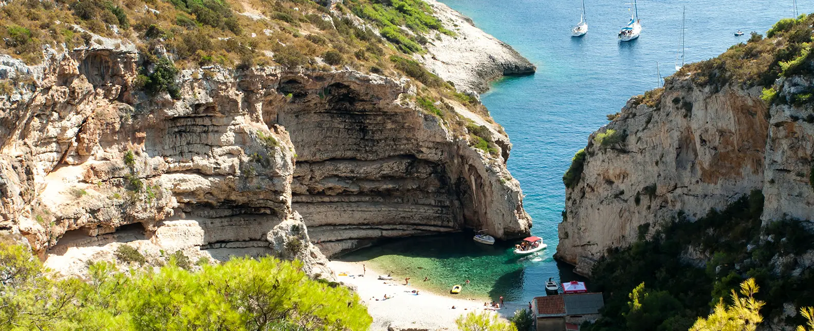
Rogoznica
via Vis & Hvar.
7-day yacht route from Marina Frapa Rogoznica via Krknjaši, Komiža (Vis), Blue Cave, Hvar, Stari Grad & Maslinica (Šolta) — sailor brief with NM.

Day-by-day route
Click any pin on the map or any day in the Route summary below to see the daily stop, narrative, and photos.

Rogoznica → Krknjaši Bay
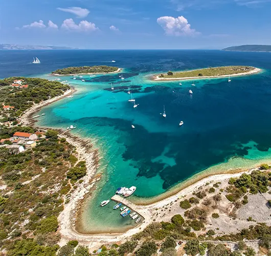
15 nm southeast from Marina Frapa Rogoznica to Krknjaši Bay between Veli and Mali Drvenik — glass-water swim anchorage 4 nm west of Trogir, sand floor at 3–6 m, holding excellent. Three small Veli Drvenik restaurants hang free buoys with dinner ashore; ideal first-night settle before pushing south.
Distance
7 NM
Sailing
~1.4h at 5 kn
Route at a glance
Route summary
Click any day to jump back to the map and see its photos, narrative, and mooring tip.
Day-by-day journey
Named anchorages, restaurants, and route notes for every leg of the week — written by sailors who've actually run this passage.

Rogoznica → Krknjaši Bay
Out of Marina Frapa Rogoznica, 15 miles southeast along the open coast and into the channel between Veli Drvenik and Mali Drvenik. Krknjaši is a swim anchorage: shallow with a pale sand floor at 3–6 metres, holding excellent. Three small restaurants on Veli Drvenik (no road access) lay free mooring buoys for guests, but anchoring on the sand floor is the more common choice. Day 1 is operational: settle the crew, deliver a quiet first night before the route turns south.
Things to do
Anchor on the sand floor in 4–6 m and swim
Walk the 30-minute headland loop on Veli Drvenik
Order grilled fish at a Veli Drvenik beach restaurant
Sample the local Plavac Mali at a quayside table
Watch the open-Adriatic sunset from the deck
Mooring tip
Anchor in 4–6 m on excellent sand holding. Free restaurant buoys also available with dinner ashore. Bay is sheltered from N, NE, E, S and SE; exposed only to W and NW.
Krknjaši Bay → Komiža
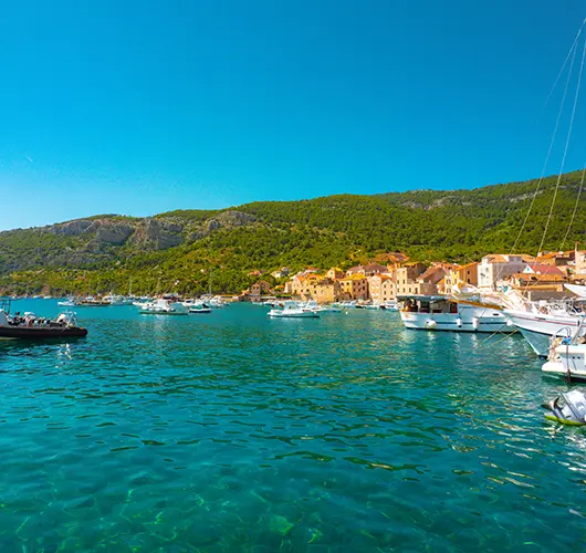
Twenty-four miles southwest to Komiža, the working fishing port on the western side of Vis. Vis is the most westerly inhabited Croatian island and the 1989 lifting of its closed-zone military status is still visible. Stern-to with own anchor on the inner basin (sand and weed, mostly good holding) — outer wall open to SW swell. Konoba scene runs to grilled bogueroni and the indigenous Vugava white. Tito's Cave on Mount Hum is open as a site, and the hike up gets you the best 360° view in central Dalmatia.
Things to do
Hike up Mount Hum (587 m) to Tito's WWII cave
Walk the working fishing fleet on the eastern harbour
Order grilled bogueroni and a glass of Vugava at a konoba
Visit the Fishermen's Museum in the Venetian tower
Watch the open-Adriatic sunset from the harbour wall
Mooring tip
Stern-to with own anchor on the inner basin of Komiža town quay. If SW gradient above 15 kn, push 6 nm north to Vis Town in St. George Bay.

Komiža → Vis
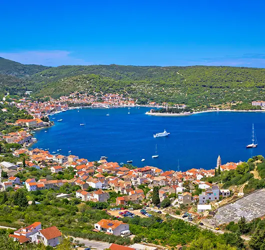
The day starts at the Blue Cave on Biševo (sun-angle 09:00–11:00, official tender ferry only). Then south to Budihovac, a small twin-islet pair with one of the cleanest swim anchorages in central Dalmatia. The afternoon push is 6 miles clockwise to Vis Town in St. George Bay — fully sheltered from S, SW, W and NW. The bay holds the Roman colony of Issa from 397 BC, with surviving thermae and Hellenistic walls along the harbour promenade.
Things to do
Queue for the Blue Cave tender between 09:00 and 10:30
Swim at Budihovac twin islet on the southern coast
Walk the Hellenistic walls along the Vis Town harbour
Climb up to the Austro-Hungarian Fort George above the town
Order peka-cooked octopus at a Vis Town konoba (book 3 hours ahead)
Mooring tip
Stern-to with own anchor on the long Vis Town seafront promenade — modest fee, water and power on the central berths. Fully sheltered from S, SW, W and NW; the most reliable overnight on Vis.

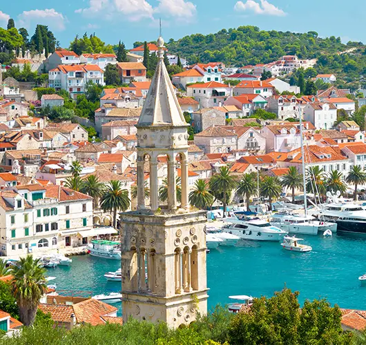
Vis → Hvar
Twenty miles east-northeast to Hvar Town. ACI Marina Hvar is the only practical overnight option for a 12-metre yacht in anything more than a flat calm — book ahead, lazy lines, water and power. Town quay accepts boats by the hour for a stiff fee but is exposed to W gusts and crowded with tenders; not viable overnight. Climb the Fortica before the heat, walk the Arsenal and St. Stephen's, then settle in for the konoba dinner in the back lanes off the central square.
Things to do
Climb the Fortica before midday for the Pakleni view
Walk the Arsenal and St. Stephen's Cathedral on the main square
Stand a round at one of the back-lane konobas
Take the lavender shop tour off Trg Sv. Stjepana
Watch the harbour traffic from the marina seawall after dark
Mooring tip
ACI Marina Hvar is mandatory in any wind — book ahead, lazy lines, water and power. Town quay is not viable overnight in season.

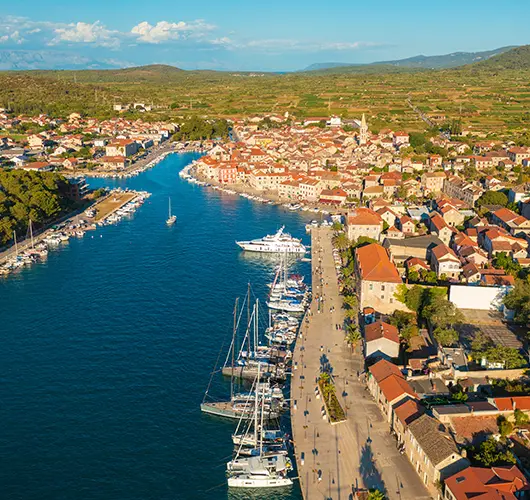
Hvar → Stari Grad
Twelve miles clockwise around the western tip of Hvar to Stari Grad. The town is the oldest in Croatia, founded as Greek Pharos in 384 BC; the original Greek street grid is still visible in the central old town, and the surrounding Stari Grad Plain — UNESCO-listed — is one of the oldest continuously cultivated landscapes in Europe. Town quay accepts stern-to with own anchor for a modest fee, ACI Marina Stari Grad on the eastern side has lazy lines.
Things to do
Walk inland through the UNESCO Stari Grad Plain
Visit Tvrdalj Castle and Hektorović's freshwater fishpond
Walk the Greek-grid streets in the central old town
Bike the lavender belt road east of Stari Grad
Order peka at a Stari Grad Plain konoba (book 3 hours ahead)
Mooring tip
Town quay stern-to with own anchor — modest harbour fee, water and power. ACI Marina Stari Grad on the eastern side has lazy lines. Bay is fjord-shaped and fully sheltered in any wind direction.

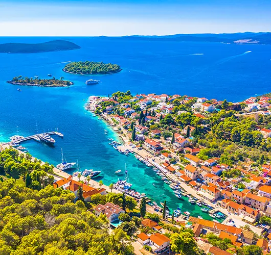
Stari Grad → Maslinica
Twenty miles northwest to Maslinica, the deep S-shaped natural harbour at the western tip of Šolta. Mooring split between Martinis Marchi Marina on the south side (lazy lines, 18th-century baroque-castle hotel) and the village quay on the north side (stern-to with own anchor). Šolta is the closest island to Split (15 miles out) but the quietest in the central Dalmatian group — the konobas in the village square run on Šoltansko olive oil and the indigenous Dobričić red.
Things to do
Walk into the Martinis Marchi castle courtyard
Order the Dobričić red, Šolta’s indigenous grape
Dinghy across to Stipanska island for the swim path
Sample Šoltansko olive oil at the village shop
Watch the sunset from Polebrnjak islet at the bay entrance
Mooring tip
Martinis Marchi Marina (south side) has lazy lines and full services — book ahead. Village quay (north side) takes stern-to with own anchor. Bay is fully sheltered from S, SW, W and NW.

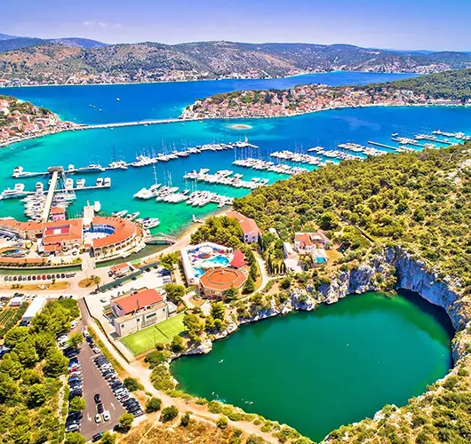
Maslinica → Rogoznica
Final leg: 15 miles northwest from Maslinica back into Marina Frapa Rogoznica. Saturday handover protocol: boat back at base by 09:00, fuel topped, holding tanks emptied, decks rinsed, inventory checked. Course passes the Drvenik islands and the south coast of Šolta — final swim opportunity in any of the small bays on the way north. With fuel pumped and inspection clear, walk the path to the Dragon's Eye Lake on the southern tip of Rogoznica peninsula one last time.
Things to do
Top up fuel and pump out before the 09:00 inspection
Walk the path to the Dragon's Eye Lake
Stand a long lunch at the marina hotel restaurant
Walk the small old quarter on Rogoznica peninsula
Sample local olive oil at a village shop
Mooring tip
Return into Marina Frapa Rogoznica per your charter contract — base manager directs the slot. Saturday handover window 08:00–09:00; arrive by 17:00 Friday if your contract specifies night-before return.
Sail this route — we'll match a yacht to it.
Send dates, group size and preferred yacht style. A broker replies with a tailored quote within hours.